
How much conserved land is there in Henrico? New interactive CRLC map shows
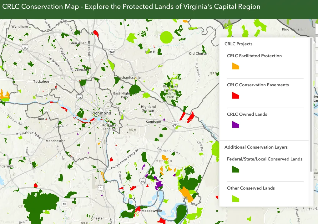
The Capital Region Land Conservancy has published a new interactive map of conserved lands in Henrico County and throughout CRLC's service area in Central Virginia.
The map displays land owned by CRLC as well as sites under conservation easements, partner projects that CRLC facilitated, and other local, state, and federally protected properties.
In addition to Henrico, the map covers the counties of Charles City, Chesterfield, Colonial Heights, Goochland, Hanover, New Kent, Petersburg and Powhatan, and the City of Richmond.
